geopandas.GeoSeries.buffer#
- GeoSeries.buffer(distance, resolution=16, cap_style='round', join_style='round', mitre_limit=5.0, single_sided=False, **kwargs)[source]#
Return a
GeoSeriesof geometries representing all points within a givendistanceof each geometric object.Computes the buffer of a geometry for positive and negative buffer distance.
The buffer of a geometry is defined as the Minkowski sum (or difference, for negative distance) of the geometry with a circle with radius equal to the absolute value of the buffer distance.
The buffer operation always returns a polygonal result. The negative or zero-distance buffer of lines and points is always empty.
- Parameters:
- distancefloat, np.array, pd.Series
The radius of the buffer in the Minkowski sum (or difference). If np.array or pd.Series are used then it must have same length as the GeoSeries.
- resolutionint (optional, default 16)
The resolution of the buffer around each vertex. Specifies the number of linear segments in a quarter circle in the approximation of circular arcs.
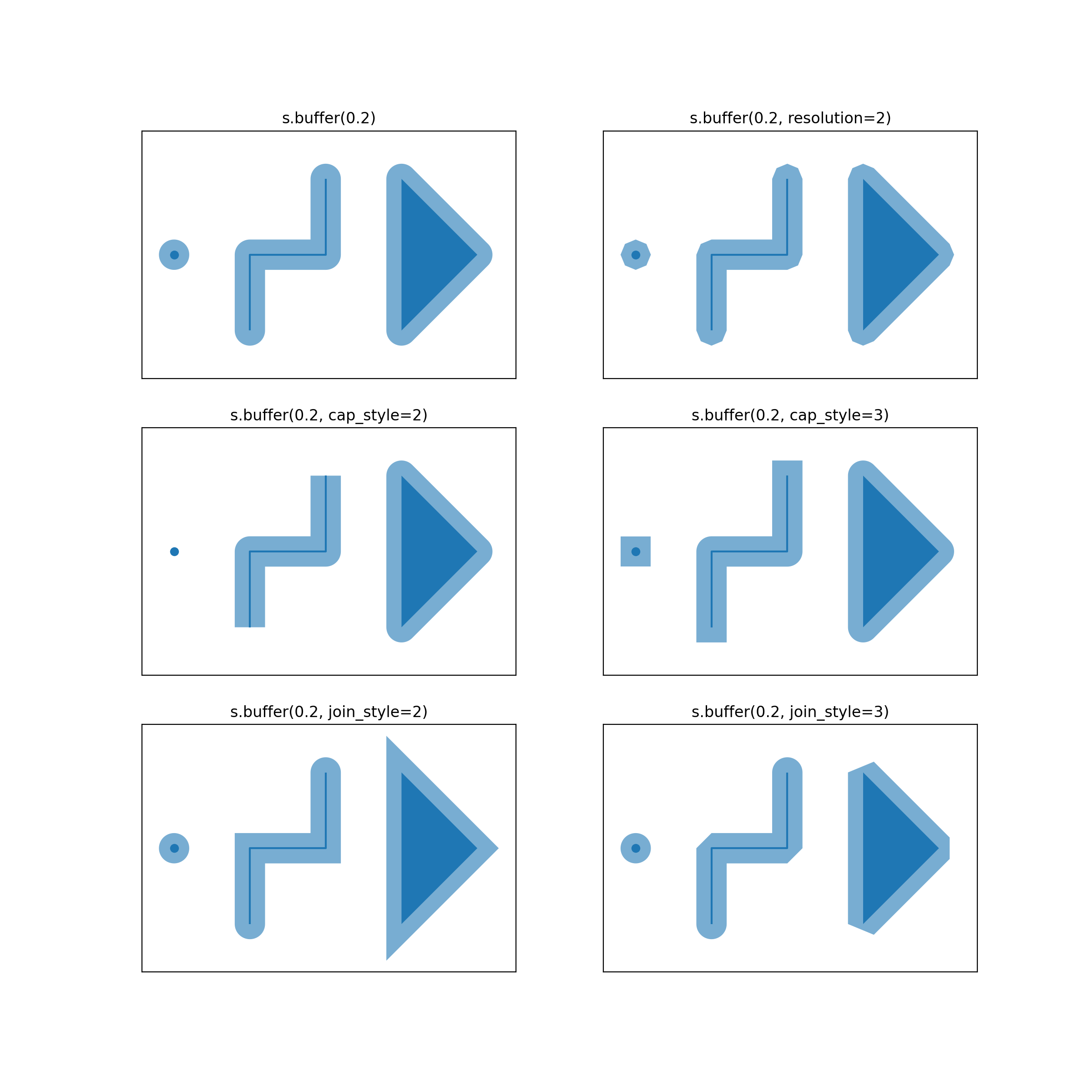
- cap_style{‘round’, ‘square’, ‘flat’}, default ‘round’
Specifies the shape of buffered line endings.
'round'results in circular line endings (seeresolution). Both'square'and'flat'result in rectangular line endings,'flat'will end at the original vertex, while'square'involves adding the buffer width.- join_style{‘round’, ‘mitre’, ‘bevel’}, default ‘round’
Specifies the shape of buffered line midpoints.
'round'results in rounded shapes.'bevel'results in a beveled edge that touches the original vertex.'mitre'results in a single vertex that is beveled depending on themitre_limitparameter.- mitre_limitfloat, default 5.0
Crops of
'mitre'-style joins if the point is displaced from the buffered vertex by more than this limit.- single_sidedbool, default False
Only buffer at one side of the geometry.
Examples
>>> from shapely.geometry import Point, LineString, Polygon
>>> s = geopandas.GeoSeries(
...     [
...         Point(0, 0),
...         LineString([(1, -1), (1, 0), (2, 0), (2, 1)]),
...         Polygon([(3, -1), (4, 0), (3, 1)]),
...     ]
... )
>>> s
0                         POINT (0 0)
1    LINESTRING (1 -1, 1 0, 2 0, 2 1)
2    POLYGON ((3 -1, 4 0, 3 1, 3 -1))
dtype: geometry
>>> s.buffer(0.2)
0    POLYGON ((0.2 0, 0.19904 -0.0196, 0.19616 -0.0...
1    POLYGON ((0.8 0, 0.80096 0.0196, 0.80384 0.039...
2    POLYGON ((2.8 -1, 2.8 1, 2.80096 1.0196, 2.803...
dtype: geometry
Further specification as ``join_styleandcap_styleare shown in the following illustration:(
Source code,png,hires.png,pdf)